Category Archives: Preservation

Sign-Up for a Historic Walking Tour

Wallabout Walking Tours (19)

Reservations are now being accepted for our popular summer historic walking tour series!  Visit our Events Calendar to find a date and to reserve a ticket.

The Myrtle Avenue Revitalization Project LDC (MARP), in collaboration with the Fort Greene Park Conservancy, will be hosting a FREE neighborhood walking tour series this summer. Two guided tours will be available each month, one exploring Fort Greene Park and the other the historic Wallabout neighborhood north of Myrtle Avenue.

The Wallabout Historic Walking Tour will discuss the neighborhood’s 400 years of history, from a rural farming community to a 20th century urban neighborhood and industrial center. This tour is held the third Saturday of each month, May through October.

The Fort Greene Park Walking Tour discusses the park history, with focus on the storied life of Walt Whitman, a leading advocate for the neighborhood park.  This tour is held the second Saturday of each month, from May through August.

Each of the tours last approximately 90 minutes and begin at 11am at the Fort Greene Park Visitor Center.  All tours are FREE and open to all.

RSVPs are required and can be made by clicking here or by calling (718) 230-1689 ext 6#.

Information on Walt Whitman, along with the reciting of some of his and other’s works during the tours, is provided by the Walt Whitman Project and the American Opera Projects.

Women’s History Month #TBT Round-up

To celebrate Women’s History Month, we shared stories of local women and institutions who have contributed to the history of Fort Greene and Clinton Hill.  Below is the collection of historic photos that were featured on our Facebook and Instagram pages as part of our ongoing #ThrowbackThursday campaign.

Mergenthaler

Mergenthaler Linotype Strike, 1946

This photo shows striking workers in 1946 at the Mergenthaler Linotype factory on Ryerson Street, between Park & Flushing Ave. Following WWII, 1,700 Mergenthaler employees – which included hundreds of women – held a 114-day strike, one of the longest in NY State history. The workers were fighting for a living wage and manageable hours. At the time, some employees reported working 67 hours/week, at an average wage of only $1/hour (which would be $12.15 today). The linotype factory first opened in 1890 and was one of five largest employers in Brooklyn in the early 20th century and eventually closed its doors here in 1959. Today, the former Mergenthaler factory at 29 Ryerson is slated to become offices, with building permits filed just last month for the conversion.

St Joseph's

St. Joseph’s College for Women

A beautiful photo from 1954 shows St. Joseph’s College for Women students at 245 Clinton Avenue, between Willoughby and DeKalb. The women’s college was founded in 1916 (happy 100th birthday!) as a day college for local young girls. The university became co-ed in 1970 and its Clinton Hill campus still serves the neighborhood today, with over 1,250 students in attendance.

Pratt's Women's Club_Hall St at Willoughby_1914

Pratt Women’s Club

This 1914 photo shows the home of Pratt’s Women’s Club, which sat the southeast corner of Willoughby Avenue & Hall Street.  The Women’s Club was founded in 1914 and they sponsored educational and social events for Pratt’s female students and provided programming for local children. The home is now gone and Pratt’s ISC building now stands at this location.

Lurita at Clinton Hill Simply Art & Framing

Myrtle Avenue’s Entrepreneurs

Today, about 30% of Myrtle Avenue’s businesses are owned and operated by women.  Many of these businesses have been serving the community for decades.  Click below to read about a few of these remarkable women:


Throwback Thursday: Brooklyn’s First Black Firefighter

210 Myrtle Avenue, seen in 1940. Photo Credit: NYPL.

210 Myrtle Avenue, seen in 1940. Photo Credit: NYPL.

This historic photo from 1940 shows the block between Fleet and Hudson along Myrtle Avenue. On this block, a few decades earlier, lived William Nicholson who at the age of 29 in 1898 became the city’s first Black fireman. While breaking the racial glass ceiling could not have been easy, as evidence by his consistent assignment to menial tasks and not being able to respond to fire calls, he endured and ended up retiring from the department and received a pension.

Thank you to Brownstone Detectives for highlighting the story on their blog.

Throwback Thursday: Raiders Cleaners

Image Credit: Patrick Cullinan.

Image Credit: Patrick Cullinan.

Taken from the Myrtle Avenue Elevated train, this photo captures a slice of Clinton Hill along Myrtle Avenue, between Clinton and Vanderbilt Avenues.  Signage for Raiders Cleaners is seen the façade of 414 Myrtle Avenue, where Mr. Coco operates today.

A laundry cleaning and dying business operated at this location for more than 60 years, beginning with Raiders Cleaners first opening in the 1940s.  The original business was then sold in the late 1950s (when “New” was added to the name), and was run by a local Fort Greene family for about 50 years.  New Raiders Cleaners closed in 2008.

This photo, which dates to 1969, was taken by Patrick Cullinan shortly before the Myrtle Avenue El came down.

Interested in more local history?  Follow us on Facebook and Instagram to catch our weekly #ThrowbackThursday posts.

Throwback Thursday: Farmer in the Deli

Farmer in the Deli, 1999.

Farmer in the Deli, 1999.

Farmer in the Deli, also known as Lauro’s to many locals, is seen here in this 1999 photo with a now retro-looking sign.  The deli has become a local institution, serving Fort Greene for decades.  The deli recently installed new signage (see below) along with a new storefront.  In 2011, the owners expanded their operations along Myrtle and opened a Clinton Hill location, simply named Farmer in the Deli II, at 543 Myrtle Avenue.

Most of the neighboring buildings seen in the photograph have since been demolished, making way for the multi-use building that now houses Greene-ville Garden and Walgreen’s.

Farmer in the Deli_New Storefront

Farmer in the Deli, 357 Myrtle Avenue at the corner of Adelphi, (718) 875-9067.

Interested in more local history?  Follow us on Facebook and Instagram to catch our weekly #ThrowbackThursday posts.


Throwback Thursday: Walt Whitman Library

Image Credit: Old NYC, NYPL.

Image Credit: Old NYC, NYPL.

This week’s Throwback Thursday photo shows the handsome Walt Whitman Branch of the Brooklyn Public Library, as it was in the 1930s.  The library, which is still open today, is currently eligible to win $20,000 through the NYC Neighborhood Library Awards.  But they need your help!  Click here to cast your vote for the local branch.

This library on St. Edward’s Street opened in 1908 and was funded by a grant from Andrew Carnegie, which built thousands of “Carnegie Libraries” across the nation.  In 1908, when the public library opened at this location, it was known as the City Park Library, due to its proximity to City Park (which is now named Commodore Barry Park).  The branch was later renamed to honor Walt Whitman, who had lived in Fort Greene.  The name change occurred on Whitman’s 125th birthday, in 1943.

Interested in more local history?  Follow us on Facebook and Instagram to catch our weekly #ThrowbackThursday posts.

TBT: 1939 at St. Edwards Street and Auburn Place

St. Edwards_demo of homes between library and ps 67_1939_NYPL

Image Credit: NYPL.

This 1939 photo , taken at the corner of St. Edwards Street and Auburn Place, captures so much Fort Greene history.  Seen on the left is a three-story building that houses an Italian bakery on the ground floor.  This building, along with hundreds of others, were demolished around 1940 to clear way for the new Fort Greene Houses.  The housing development, built by the City, was the largest of its kind at the time it was planned, spanning close to 40 acres and housing 13,000 residents.

A few buildings were spared from the wrecking ball however, including the two seen in these photograph: P.S. 67 and the Walt Whitman Branch of the Brooklyn Public Library.

This photo captures P.S. 67 just prior to the addition of its south wing, which still stands today.  The school today is named after Charles A. Dorsey, a former principal who served the school for more than 30 years and oversaw its integration into Brooklyn’s desegregated public school system in the 1890s.  Prior to desegregation, the school only served Black students and was named Colored School No. 1, as it was the first public school for Brooklyn’s Black children when it opened in 1827.

The Walt Whitman library opened in 1908 and was funded by a grant from Andrew Carnegie, whose philanthropy built hundreds of “Carnegie” libraries across the country.  Originally, the library opened as the City Park Branch but later changed it’s name to Walt Whitman in 1943, to honor the local poet’s 125th birthday.  The library is still open today and offers a wide range of services to the community.

Interested in local history?  Be sure to follow us on Instagram or Facebook and never miss future #ThrowbackThursday photos.


Throwback Thursday: Myrtle Avenue’s Drive-Thru Restaurants

tbt (1)

1999 photo of Kentucky Fried Chicken at 524 Myrtle Avenue.

In the not so distant past, a number of stand-alone fast food restaurants could be found on Myrtle Avenue in Fort Greene and Clinton Hill.  These included White Castle and two Kentucky Fried Chickens, one at the corner of Ashland Place and Myrtle Avenue, and the one pictured here near the corner of Myrtle Avenue and Steuben Street.

This photo, taken in 1999, shows the Clinton Hill outpost of KFC, which closed around 2007 when the property was redeveloped to house Pratt Institute’s new Myrtle Hall building.  In it’s place, three Brooklyn-based businesses now operate, including Bergen Bagels, Khim’s Millenium Market and Blick Art Supply.  The single-story, drive-through building had been built in the late 1980s.

Across the street, White Castle stood on the northwest corner of Steuben Street and Myrtle Avenue for 25 years.  The building was demolished this year, and the site will be redeveloped with a five-story mixed-use building with ground-floor commercial space and 27 apartments above.

531 Myrtle Avenue, replacing the former White Castle building.

Rendering of 531 Myrtle Avenue, currently under construction at the corner of Myrtle Avenue and Steuben Street. Photo Credit: AB Architekten.

The other Myrtle Avenue KFC location, in Fort Greene, was replaced with The Andrea building which now houses CVS and Red Apple Supermarket on the lower floors, and 95 apartments above.

Former Kentucky Fried Chicken at 220 Myrtle Avenue (corner of Ashland Place), as seen in 2006 prior to its demolition.

Former Kentucky Fried Chicken at 220 Myrtle Avenue (corner of Ashland Place), as seen in 2006 prior to its demolition.

Interested in more local history?  Follow us on Facebook and Instagram to catch our weekly #ThrowbackThursday posts.

Storefront Renovation Work Slated for Myrtle Avenue

NYMS Tepango Storefront Drawings Plans

Thanks to a grant from New York State, several property and business owners along Myrtle Avenue in Clinton Hill will undertake some building renovation work this fall.  Four projects are currently being planned to install new storefronts, renovate commercial interiors and restore historic building facades along Myrtle Avenue between Grand and Classon avenues.

The projects will also receive assistance from the Myrtle Avenue Revitalization Project LDC (MARP) through a grant that was awarded to the organization by New York State.  The New York Main Street grant program, administered by NYS Homes and Community Renewal, allows property and business owners to receive matching grants to offset costs associated with building restoration and renovation work.

The first projects slated to begin work will be at Tepango Restaurant and Bella Rosa Flowers, which will both see new storefronts installed.  In addition, the restaurant owner at Tepango will make some upgrades inside the restaurant throughout the dining area.

Other projects slated for assistance will involve restoring historic building facades and installing new storefronts at spaces that are currently vacant.  The goal of these projects is to create new commercial spaces and attract new businesses to open new stores or restaurants in these ground-floor spaces.

MARP has been awarding New York Main Street grants to local property and business owners for the past eleven years.  The grants provide a reimbursable 3-to-1 match, requiring that grant recipients cover at least 25% of the project’s total cost.  To date, MARP has assisted 41 projects along Myrtle Avenue by awarding more than $827,000 in grants, which local business and property owners have matched with more than $2 million in private financing.

Throwback Thursday: Former P.S. 4 at Ryerson and Myrtle

PS 69_Ryerson St south of Myrtle_1930_NYPL

A photo from the 1930s showing P.S. 69, formerly known as P.S. 4, at 155 Ryerson Street, between Myrtle and Willoughby Avenues. Photo Source: New York Public Library.

For over fifty years, there stood a beautiful three-story school building at 155 Ryerson Street, near Myrtle Avenue, in the footprint of where the new Key Food Supermarket is slated to reopen in September.

Originally opened in the 1870’s, Public School No. 4 served local children who lived between Lafayette Avenue and the Navy Yard in (what is now referred to as) the Clinton Hill section of Brooklyn.  By 1876, the school had over 1,500 stude#Tnts enrolled.

By the 1920s, enrollment began to decline, making room available for other uses in the building.  By 1929 sixteen of the school’s rooms were used as an annex space for the overcrowded Brooklyn Technical High School.  The high school was so overcrowded that P.S. 4 (which had been renamed P.S. 69) had four annexes sprinkled throughout the neighborhood.

By 1942 the small school building and dwindling enrollment allowed the board of education to close the schedule and reassign students to other primary schools nearby.  Shortly after, the Department of Sanitation opened offices in the building and remained there until the mid-1950s.  At that point, the Willoughby Walk cooperative apartments were planned for the site, which were planned under Robert Moses’ watch as part of a city-wide redevelopment plan.

By the end of the decade, the school building had been demolished (along with everything else on the block).  In its place stood a one-story commercial building which once housed an A&P supermarket.  More recently, that supermarket space was occupied by Associated Supermarket.  The same owners plan on returning to the site, within the new building at 490 Myrtle Avenue, and opening a Key Food grocery store before the end of September.

Corner of Myrtle Avenue and Ryerson Street, as seen in 1969, with the Willoughby Walk Co-ops in the background.

490 Myrtle Avenue, as seen in July 2015. By September, the new Key Food Supermarket plans to open in the building. Photo Credit: Aufgang Architects.

Throwback Thursday with Author Henry Miller

Picture1

Here’s a throwback to the 1930s with local author Henry Miller, who once lived at 180 Clinton Avenue, near the corner of Myrtle Avenue.  It’s quite apparent that Mr. Miller was not found of Myrtle Avenue when he lived in the area back in the 1920’s.  In 1929, he and his wife left Clinton Hill, and Brooklyn all together, and became expats in Paris.

The above passage is from Miller’s novel Tropic of Capricorn.  The book was a prequel to Tropic of Cancer and was banned in the United States for over twenty years for being too “obscene.”

We’d like to think that if the author visited Myrtle Avenue today – maybe got brunch at The Runner or enjoyed a cupcake at Brooklyn Sweet Spot – he’d find a little more love for our beloved thoroughfare?

180 Clinton Avenue, between Myrtle and Willoughby Avenues.

180 Clinton Avenue, between Myrtle and Willoughby Avenues.

Interested in more local history?  Follow us on Facebook and Instagram to catch our weekly #ThrowbackThursday posts.

Throwback Thursday: 1940 & 2015 at 413 Myrtle Avenue

black_white

Photos of 413 Myrtle Avenue, between Vanderbilt and Clinton, from 2015 and 1940.

This 1940 photo of 413 Myrtle Avenue, the longtime home of Yummy Yummy Chinese, shows that the space also housed a restaurant 75 years ago.  Next door to the restaurant was both a drug store and the Delta Brothers Butcher shop, which now houses Splitty bar.

A new restaurant will be opening this summer in the ground floor space at 413 Myrtle Avenue.  The new sit-down eatery will serve a menu that features cuisine from the Oaxaca region of Mexico.  The name of the new restaurant has not yet been announced, but the owner says the targeted opening date will be in later summer 2015.

Yummy Yummy Chinese Restaurant closed last month, after serving the neighborhood for several decades.  Fortunately, if you are craving classic take-out Chinese food, you can still visit many other options nearby, including: Hardee’s, Chung Chun Kitchen or Kum Kau Restaurant.  Click here to view a list of all Chinese restaurants on Myrtle Avenue in Fort Greene and Clinton Hill.


Full 1940's tax photo of 413 Myrtle Avenue.

Full 1940’s tax photo of 413 Myrtle Avenue.

Interested in more local history?  Follow us on Facebook and Instagram to catch our weekly #ThrowbackThursday posts.

Throwback Thursday: 1940 on Myrtle Avenue in Clinton Hill

1940's photograph of 555-559 Myrtle Avenue, between Emerson and Classon.

1940’s photograph of 555-559 Myrtle Avenue, between Emerson and Classon.

This 1940 photo shows a stretch of Myrtle Avenue, between Emerson Place and Classon Avenue, in Clinton Hill.  The storefront that once housed a meat market is now home to Brewklyn Grind coffee shop.  Next door, on the right side of the photo, is home today to Leisure Life NYC and is seen here in 1940 as a plumbing supply store.  On the left side of the photo, the Hollywood produce market is shown in operation.  This fruit and vegetable market, owned by the Venezia family, opened in 1935 and remained open for more than 72 years, closing when the owners retired in 2007.

This photo was taken by the city in 1940, when the tax department snapped a photo of each and every lot across the five boroughs.  Later, an updated photo survey was undertaken by the city in 1980.  Photos of any property can be ordered through the city’s Department of Records.

Interested in more local history?  Follow us on Facebook and Instagram to catch our weekly #ThrowbackThursday posts.

Mapping Brooklyn at BRIC House

BRIC Mapping BrooklynBRIC and Brooklyn Historical Society Present Mapping Brooklyn, an exhibition juxtaposing historic maps with mapping-themed works by contemporary artists. The show is on view at BRIC House, 647 Fulton Street in Downtown Brooklyn from from February 26 to May 3.

BRIC and Brooklyn Historical Society (BHS) are pleased to co-present Mapping Brooklyn, a new exhibition featuring contemporary art works that use mapping and cartography as themes alongside actual historic maps. Curated by Elizabeth Ferrer, Vice President of Contemporary Art at BRIC, and spanning the galleries at BRIC House, 647 Fulton Street, and Brooklyn Historical Society, 128 Pierrepont Street, Mapping Brooklyn explores the myriad ways that maps can represent practical matters such as wayfinding, property ownership, population shifts and war strategy, while also navigating the metaphorical, the psychological and the personal. At both venues, historic maps and contemporary works will be in dialogue, suggesting common themes—the desire to explore, chart, and analyze territory—and highlighting the innovative ways that contemporary artists use mapping, cartography and exploration, to reveal data, ideas and emotions.

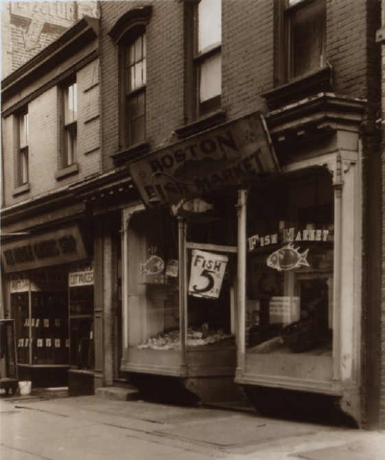
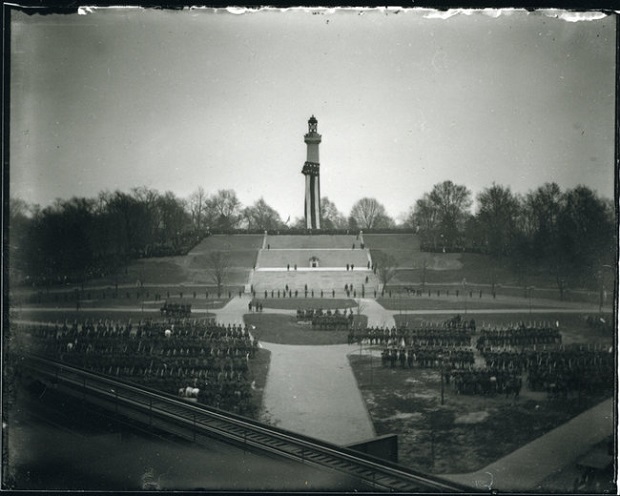
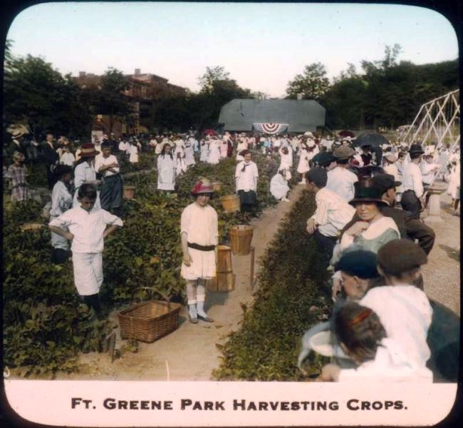
The historic maps will be drawn from BHS’s collection, one of the richest collections of maps of Brooklyn in the world. Included are fire insurance maps, transportation maps, demographic maps and nautical charts, among others. A colorful pictorial road map to the 1939 New York World’s Fair, a commercial edition of a Red Scare-era map depicting enclaves of suspected radical activity, and a detailed map of one of Brooklyn’s earliest botanic gardens, showing plots of exotic plants and fruits, are among the dozen or so maps and atlases on display.

Artworks will range widely in scale and medium, including painting, photography, drawing, sculpture, installations, interactive projects, and appropriated and manipulated historic and contemporary documents. Many of the artists have conducted research into the BHS map collection and have selected the historic maps that will be shown alongside their work. Participating artists include Aaron Beebe, Daniel Bejar, Francisca Benitez, Gail Biederman, Justin Blinder, Christine Gedeon, Katarina Jerinic, Joyce Kozloff, Laura Kurgan, Peter Lapsley, Jennifer Maravillas, Simonetta Moro, Bundith Phunsombatlert, Jan Rothuizen, Patricia Smith, Nick Vaughan & Jake Margolin, and Sarah Williams.

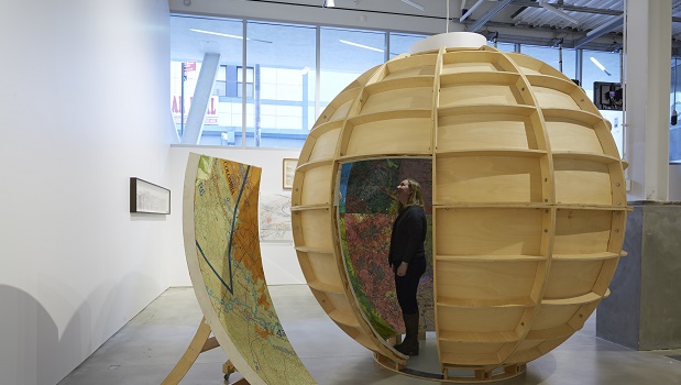
Works include a monumentally scaled map of Brooklyn by Jennifer Maravillas, made from paper litter collected on epic walks through every block in the borough; a nine-foot diameter walk-in globe painted with aerial maps of sites involved in U.S. military warfare, by Joyce Kozloff; a special project by Amsterdam-based artist Jan Rothuizen, who will retrace the steps a 17th-century Dutch explorer laid years ago and document his modern-day journey with a series of drawings of people and places in contemporary Brooklyn; and digitized maps that study such phenomena as human emotions as tracked and mapped by Foursquare and created by data visualization designer and geographer Sarah Williams.

BRIC Arts | Media House, 647 Fulton Street (at Rockwell Place) in Downtown Brooklyn
Gallery hours are Tuesdays & Thursdays 10am-8pm; and, on all other days, 10am – 6pm.
The gallery is closed Monday. Admission is free.

Brooklyn Historical Society is located at 128 Pierrepont Street (at Clinton Street) in Brooklyn Heights. Museum hours are Wednesday to Sunday, 12 – 5pm.


Throwback Thursday: Corner of Clinton & Myrtle Avenue

419 Myrtle Avenue 1999

Corner of Myrtle and Clinton Avenues in 1999. Today, you’ll find Putnam’s Pub and Cooker in this corner spot.

If you walk past the corner of Myrtle and Clinton Avenues today in Clinton Hill, you’ll find the popular bar and restaurant Putnam’s.  The pub sits in a beautifully restored building, with apartments on the upper-floors.  Sixteen years ago, the building was in a very different state, as this 1999 photo shows.  The building’s only tenant was the corner grocery while the upper-floors sat empty.

Putnam’s, which opened in 2011, is gearing up for their annual St. Patrick’s Day Celebration.  Their two-day celebration will include FREE oysters, live music, Irish dancing, and plenty of traditional Irish dishes.  Click here to check out all of the details.

Putnam’s Pub and Cooker, 419 Myrtle Avenue, corner of Myrtle and Clinton Avenues.

Corner of Myrtle and Clinton Avenues, as seen in 2014.

Corner of Myrtle and Clinton Avenues, as seen in 2014.


Thwoback Thursday: Miracle’s Barber Shop

470 Myrtle Avenue

Photo taken by William Gedney. Image Source: Duke University Libraries, William Gedney Collection.

This photo is a throwback to 1969, at 470 Myrtle Avenue (between Washington Ave and Hall St), home to Crescent Barber Shop. If you visit 470 Myrtle today, you’ll still find men and women looking for a fresh cut, at Miracle’s Barber Shop. Miracle’s just moved into the space last month from their previous location just across the street, where they’ve been doing business for more than a decade. Congrats to Miracle’s on the new space!

Miracle’s Barber Shop, 470 Myrtle Avenue, between Washington Avenue and Hall Street.

Throwback Thursday: Myrtle Avenue & Waverly in 1940

448 Myrtle TAX photo

This photograph, from 1940, is part of New York City’s vast collection of 1940 tax photos.  In 1940, the city took on an ambitious project of photographing each tax lot within the city.  Fortunately for us, these now historic photographs help us to see how neighborhood looked more than 70 years ago.

The shot here is of Myrtle Avenue, the south side of the street between Waverly and Washington Avenue.  The storefront on the right, with all of the small glass panes, is now home to the new Optical Gallery.  Next door to the left, today you will find Thai 101 Bistro and Clinton Hill Hardware.  The storefronts have changed a lot of the years, and the Myrtle Avenue “el” train is now gone, but what you can still find today is the beautiful cast iron facade at 448 Myrtle Avenue.

Interested in more local history?  Follow us on Facebook and Instagram to catch our weekly #ThrowbackThursday posts.

1908 Unveiling of the Prison Ship Martyrs’ Monument

Prison Ship Martyrs' Monument unveiling, November 14, 1908.

Prison Ship Martyrs’ Monument unveiling, November 14, 1908.

Over a century ago, in 1908, a new Prison Ship Martyrs’ Monument was unveiled in the center of Fort Greene Park.  The monument commemorates more than 11,000 people who died here in the neighborhood during the Revolutionary War.  For seven years during the war, the British held American prisoners aboard ships in Wallabout Bay, where the Brooklyn Navy Yard sits today.  Due to lack of hygienic conditions, sanitary food, water and rampant spread of disease, thousands of prisoners lost their lives aboard these ships.  Remains of some of those killed aboard the ships were moved to a crypt that sits below the monument.

You can read more about the fascinating history of the prisoners and efforts to memorialize their lost over at “On the Ground History” blog.


Throwback Thursday: Soketah Hair Divas

406_TBT

This photo takes us back to 2006, to the previous location of Soketah Hair Divas at 406 Myrtle, between Clinton & Vanderbilt. Today, the storefront is home to Metro PCS (formerly Verizon).

The unisex hair salon has called Myrtle Avenue home for 13 years. The shop is now located at 563 Myrtle, between Emerson and Classon. They have also expanded over the years and added Shic by Soketah, a hair, nail and beauty bar, located just across the street at 564 Myrtle Avenue.

Interested in more local history?  Follow us on Facebook and Instagram to catch our weekly #ThrowbackThursday posts.

#TBT at the Pratt Station Post Office

Image Source: Pratt Institute Library, Digital Collection.

Image Source: Pratt Institute Library, Digital Collection.

Ever wonder why the post office on Myrtle Avenue is called the “Pratt Station” post office?  The short answer: it used to be on Pratt’s campus in what is now known as Thrift Hall.

Thrift Hall, at the corner of Ryerson & DeKalb, was built in 1916 to house Pratt’s Thrift Association.  The Thrift Association was essentially a bank that promoted saving and money management among the neighborhood’s working class.

In 1940, the bank closed and the U.S. Post Office moved into their new “Pratt Station” location.  The name stuck with the post office when it made the move to its current location at 524 Myrtle Avenue in the late 1960’s. The post office is posed to move yet again and is currently looking for a new space in the neighborhood.  Learn more about their search or how you can give feedback on their move in this newsletter from Community Board 2.

There are plans to remove the building that post office currently leases and develop a multi-story building in its place.  A similar building is already under construction next door at 490 Myrtle Avenue, where Associated Supermarket will reopen, along with a TD Bank.

Interested in more local history?  Follow us on Facebook and Instagram to catch our weekly #ThrowbackThursday posts.

Pratt Station Post Office, January 1958.  Image Credit: Brooklyn Historical Society Digital Collection.

Pratt Station Post Office, January 1958. Image Credit: Brooklyn Historical Society Online Image Gallery.

Throwback to 1915 in Fort Greene Park

Image Credit: NYC Department of Parks & Recreation

Image Credit: NYC Department of Parks & Recreation

At the beginning of the 20th century, New York City had a program where crops were grown across the city in various parks.  Fort Greene Park hosted a fairly large garden, where the city would hold organized harvesting days for local residents.  This photo, from around 1915, shows a busy harvesting day with many locals stopping by to pick fresh food.

While you won’t find a mini-farm in Fort Greene Park today, you can still enjoy local food that is grown right here in the neighborhood.  The local Farm to Neighborhood program pairs neighborhood restaurants and food shops with local farms.  And yes, some of the food is even grown in Fort Greene and Clinton Hill, such as in the Brooklyn Navy Yard by Brooklyn GrangeClick here to find a local Farm to Neighborhood business.

Interested in more local history?  Follow us on Facebook and Instagram to catch our weekly #ThrowbackThursday posts.

#TBT to 2007 at Duncan’s Fish Market

Mr. Gurvan Duncan, owner of Duncan's Fish Market at 385 Myrtle Avenue.

Mr. Gurvan Duncan, owner of Duncan’s Fish Market at 385 Myrtle Avenue, as seen in a 2007 photo from the Myrtle Avenue Home Grown and Locally Owned campaign.

Duncan’s Fish Market, owned by Gurvan Duncan, has called Myrtle Avenue home for over 15 years. The local institution offers fresh daily catches as well as prepared food, such as sandwiches, fish and chips, mac and cheese, and rice and beans. Stop by to grab a prepared lunch or pick up fresh fish or shrimp to use in your homemade dinner.

Most of the employees you find in Duncan’s have been working in the shop since its original opening. In addition to fresh fish and homemade sides, you can always find a friendly smile from Mr. Duncan.

Duncan’s Fish Market is one of 100 businesses along Myrtle Avenue in Fort Greene and Clinton Hill that have been open for 15 years or more. Mr. Duncan, and dozens of other business owners, have contributed to the success of Myrtle Avenue and the surrounding neighborhood. Learn more about Mr. Duncan, and other members of the diverse group of Myrtle Avenue business owners, in the Home Grown and Locally Owned campaign.

Duncan’s Fish Market, 385 Myrtle Avenue, between Clermont and Vanderbilt Avenue.

A Historic #TBT at 350 Myrtle Avenue

1940's Tax Photo of 350 Myrtle Avenue.  Photo purchased from the NYC Department of Records.

1940’s Tax Photo of 350 Myrtle Avenue. Photo purchased from the NYC Department of Records.

This photo of 350 Myrtle Avenue, between Carlton and Adelphi, dates from 1940.  The photo captures Tony’s Express Storage and Warehouse, the tenant at the time.  At this point, the handsome Romanesque Revival building had been around for 40 years.

Today, Gnarly Vines wine shop calls the space home.  If you pass the building now, you’ll notice the closed-up storefront and boarded-up upper floor windows have been removed.  Also missing today are the Myrtle Avenue trolley tracks in the street and the Elevated train tracks above.

Interested in more local history?  Follow us on Facebook and Instagram to catch our weekly #ThrowbackThursday posts.

#TBT at Fort Greene Houses, 1944

Image Credit: LaGuardia-Wagner Archives.

Image Credit: LaGuardia-Wagner Archives.

This photo captures Fort Greene Houses (now known as Whitman and Ingersoll Houses) exactly 70 years ago this week.  On January 19, 1944, the grounds of the recently completed development are filled with military personnel and civilians who were employed at the nearby Brooklyn Navy Yard.  During World War II, the Yard employed more than 70,000 people.  The recently complete public housing provided the much needed housing for this large surge in the neighborhood’s population.  It wasn’t until after the war that the buildings would fulfill their original purpose as affordable housing.

Visit the LaGuardia-Wagner Archies at LaGuardia Community College to learn more.

Interested in more local history?  Follow us on Facebook and Instagram to catch our weekly #ThrowbackThursday posts.

#TBT at Kum Kau Restaurant

Image Credit: Ted Lewin, author and illustrator of Big Jimmy's Kum Kau Chinese Take Out.

Image Credit: Ted Lewin, author and illustrator of Big Jimmy’s Kum Kau Chinese Take Out.

Kum Kau Restaurant has been on Myrtle Avenue in Clinton Hill for more than 38 years.  The restaurant, on the corner of Washington and Myrtle, has been a local institution for years and was even featured in a children’s book.  Big Jimmy’s Kum Kau Chinese Take Out, written and illustrated by neighborhood resident and Pratt Institute alum Ted Lewin, provides today #ThrowbackThursday image.  The watercolor illustration captures Kum Kau in 2001, and it looks like not much has changed in the past 13 years at this local landmark.

Big Jimmu’s Kum Kau Chinese Take Out by Ted Lewin, published by Harper Collins Publishers, 2001.

Interested in more local history?  Follow us on Facebook and Instagram to catch our weekly #ThrowbackThursday posts.